ZIP Code 5: 80602 - BRIGHTON, THORNTON, CO
ZIP Code 80602 is the postal code in BRIGHTON, CO. Besides the basic information, it also lists the full ZIP code and the address of ZIP code 80602. Whatsmore, there is more information related to ZIP Code 80602. For example, nearby ZIP code around ZIP Code 80602, etc.
ZIP 80602 Basic Information

The basic information of ZIP Code 80602 is as follows, including: country, county, city, FIPS and etc.
| State | County | City | ZIP Code 5 |
|---|---|---|---|
| CO - Colorado | Adams County | BRIGHTON | 80602 |
| CO - Colorado | Adams County | THORNTON | 80602 |
📌It means zip code 80602 is across counties/cities.
What is the plus 4 zip code for 80602 ZIP Code? Below is the detail.
80602 ZIP+4 Code List

What are the 4 digit zip extensions of ZIP Code 80602? ZIP code 80602 has many plus 4 codes, and each plus 4 code corresponds to one or more addresses. Below we list all the ZIP+4 codes and their addresses in the ZIP Code 80602. You can find a 9-digit ZIP Code by a full address.
| ZIP Code 5 Plus 4 | Address |
|---|---|
| 80602-4000 | 14800 (From 14800 To 14899) SYRACUSE WAY, THORNTON, CO |
| 80602-4001 | 7700 (From 7700 To 7799) 148TH DR, THORNTON, CO |
| 80602-4002 | 7800 (From 7800 To 7899) 148TH DR, THORNTON, CO |
| 80602-4003 | 7900 (From 7900 To 7999) 148TH DR, THORNTON, CO |
| 80602-4004 | 8000 (From 8000 To 8099) 148TH DR, THORNTON, CO |
| 80602-4005 | 8100 (From 8100 To 8199) 148TH DR, THORNTON, CO |
| 80602-4006 | 14700 (From 14700 To 14799) ULSTER LOOP, THORNTON, CO |
| 80602-4200 | 12460 (From 12460 To 12491) MAGNOLIA WAY, THORNTON, CO |
| 80602-4201 | 12500 (From 12500 To 12581) MAGNOLIA WAY, THORNTON, CO |
| 80602-4202 | 12507 (From 12507 To 12597 Odd) NEWPORT ST, THORNTON, CO |
- Page 1
- ››
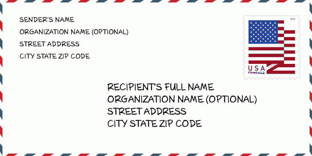
How to write a U.S. envelope?

-
First, you need to fill in the recipient's mailing information in the center of the envelope. The first line is the recipient's name, the second line is the street address with a detailed house number, and the last line is the city, state abbr, and ZIP Code.
Second, write the sender's information on the left top corner of the envelope. If your mail cannot be delivered, it will return to the sender's address.
Finally, don't forget to stick the stamp on the right top corner. Otherwise, the letter will not go into the delivery process.
Here is the envelope example below.
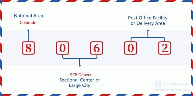
What does each digit of ZIP Code 80602 stand for?
-
The first digit designates a national area, which ranges from zero for the Northeast to nine for the far West.
The 2-3 digits represent a sectional center facility in that region.
The last two digits designate small post offices or postal zones.
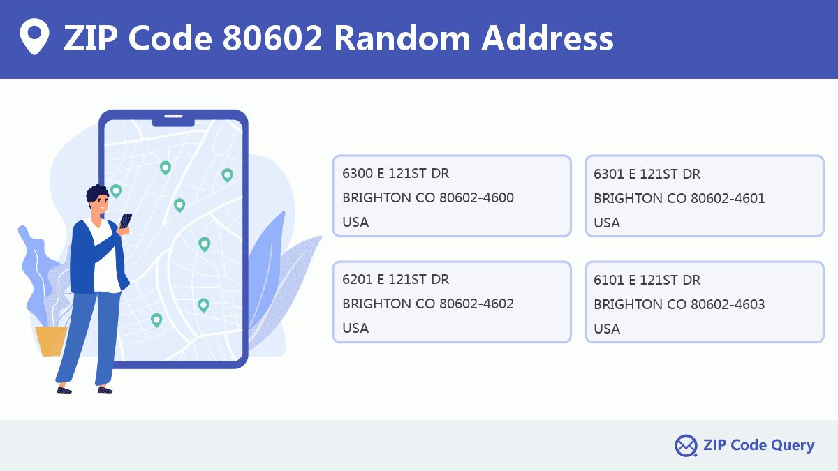
Random Address in ZIP 80602

ZIP Code 80602 has 3,979 real random addresses, you can clicking the picture below to get random addresses in ZIP Code 80602.
ZIP 80602 Online Map

This is online map of the address BRIGHTON, Adams County, Colorado. You may use button to move and zoom in / out. The map information is for reference only.
ZIP 80602 NearBy ZIP Code
The Nearby ZIP Codes are 80241, 80614, 80233, 80640, and 80601, you can find ZIP codes in a 25km radius around ZIP Code 80602 and the approximate distance between the two ZIP codes.
The data has a slight deviation for your reference only.
| ZIP Code | Distance (Kilo Meters) |
|---|---|
| 80241 | 5.224 |
| 80614 | 5.848 |
| 80233 | 7.112 |
| 80640 | 8.237 |
| 80601 | 9.127 |
| 80023 | 9.601 |
| 80234 | 10.105 |
| 80603 | 11.719 |
| 80024 | 12.337 |
| 80229 | 12.449 |
| 80260 | 12.987 |
| 80514 | 12.99 |
| 80022 | 13.958 |
| 80031 | 14.614 |
| 80037 | 14.947 |
| 80020 | 15.141 |
| 80516 | 15.627 |
| 80038 | 15.927 |
| 80530 | 16.48 |
| 80035 | 17.573 |
| 80520 | 17.727 |
| 80036 | 17.753 |
| 80030 | 17.843 |
| 80221 | 18.053 |
| 80026 | 18.661 |
| 80621 | 18.871 |
| 80003 | 19.182 |
| 80216 | 19.185 |
| 80239 | 19.525 |
| 80238 | 20.811 |
| 80249 | 21.022 |
| 80207 | 21.509 |
| 80027 | 21.551 |
| 80005 | 21.634 |
| 80041 | 21.637 |
| 80266 | 21.639 |
| 80021 | 21.953 |
| 80205 | 22.526 |
| 80001 | 22.97 |
| 80006 | 22.97 |
| 80211 | 23.316 |
| 80047 | 23.459 |
| 80294 | 23.631 |
| 80040 | 23.68 |
| 80202 | 23.878 |
| 80212 | 23.903 |
| 80045 | 23.96 |
| 80294 | 23.983 |
| 80265 | 24.189 |
| 80010 | 24.312 |
| 80293 | 24.334 |
| 80004 | 24.446 |
| 80290 | 24.49 |
| 80002 | 24.499 |
| 80264 | 24.628 |
| 80220 | 24.93 |
| 80201 | 24.94 |
| 80217 | 24.94 |
| 80243 | 24.943 |
| 80244 | 24.943 |
| 80248 | 24.943 |
| 80250 | 24.943 |
| 80256 | 24.943 |
| 80257 | 24.943 |
| 80259 | 24.943 |
| 80261 | 24.943 |
| 80263 | 24.943 |
| 80271 | 24.943 |
| 80273 | 24.943 |
| 80274 | 24.943 |
| 80281 | 24.943 |
| 80291 | 24.943 |
| 80299 | 24.943 |

Library in ZIP Code 80602

This is the ZIP Code 80602 - Library page list. Its detail Library Name, Address, City, State, ZIP Code, Phone is as below.
| Name | Address | City | State | ZIP Code | Phone |
|---|---|---|---|---|---|
| RANGEVIEW LIBRARY DISTRICT | 5877 EAST 120TH AVENUE | THORNTON | CO | 80602 | (303) 288-2001 |
| WRIGHT FARMS | 5877 EAST 120TH AVENUE | THORNTON | CO | 80602 | (303) 405-3200 |
School in ZIP Code 80602

This is the ZIP Code 80602 - School page list. Its detail School Name, Address, City, State, ZIP Code is as below.
| School Name | Address | City | State | Grades | ZIP Code |
|---|---|---|---|---|---|
| Prairie Hills Elementary School | 13801 Garfield Place | Thornton | Colorado | KG-5 | 80602 |
| Shadow Ridge Middle School | 12551 Holly Street | Thornton | Colorado | 6-8 | 80602 |
Comment


Add new comment